A waterway is any navigable body of water
These include rivers, lakes, seas, oceans, and canals. In order for a waterway to be navigable, it must meet several criteria: The waterway must be deep enough to allow the draft depth of the vessels using it; The waterway must be wide enough to allow passage for the beam width of the vessels using it; The waterway must be free of barriers to navigation such as waterfalls and rapids, or have a way around them (such as canal locks and boat lifts); The current of the waterway must be mild enough to allow vessels to make headway. Vessels using waterways vary from small animal-drawn barges to immense ocean tankers and ocean liners, such as cruise ships.

Click an Image below for a larger view - Click again to close
CanalsCanals are waterways that are constructed to provide a new path of travel for vessels (as opposed to improving a natural waterway along its current course). At one time, canals were built mostly for small wooden barges drawn by horses or other draft animals. Today, major canals are built to allow passage of large ocean-going vessels (see Stockton Deepwater Channel).
Tidal waterwayA tidal waterway is one open to the sea and far enough downstream (close enough to the sea) to be subject to twice-daily (or daily, depending on the local tides) reversals of flow and variation in depth. Non-tidal waterways are either far enough upstream to be beyond tidal effects, or are separated from the sea or the tidal stretch of the same waterway by a barrier (usually a navigation lock).
In actuality, every body of any liquid on the face of the Earth is subject to tides�even a bird bath. However, only bodies of water susceptible to tidal changes noticeable to humans are included in the customary definition. In and around San Joaquin County are thousands of waterways, that include creeks, rivers, and sloughs. The major rivers are San Joaquin River, Cosumnes River, Mokelumne River, Calaveras River, Tuolumne River and the Sacramento river
Sacramento Valley
Sacramento River
The Sacramento River is the longest river entirely within the United States state of California. Starting at the confluence of the South Fork and Middle Fork Sacramento River, near Mount Shasta in the Cascade Range, the Sacramento flows south for 447 miles (719 km) , through the northern Central Valley of California, between the Pacific Coast Range and the Sierra Nevada.
Not far downstream from its confluence with the American River, the Sacramento River joins the San Joaquin River in the Sacramento River Delta, which empties into Suisun Bay, the northern arm of San Francisco Bay. It is the third largest river by volume emptying into the Pacific Ocean in the Continental United States, behind only the Columbia River and the Colorado River.
San Joaquin Valley
Bear Creek
Cosumnes RiverThe Cosumnes River (pronounced ka-SUM-neez or ka-SUM-ness) is a tributary of the Mokelumne River (pronounced mo-KUL-lum-nee), approximately 80 mi (128.75 km) long, in northern California in the United States. The Cosumnes is often mis-pronounced as ka-SOOM-ness or kun-SOOM-ness, which is incongruent with pronunciation of other regional rivers with the same root (e.g., Tuolumne, Mokelumne.
Claimed to be the last undammed river flowing from the western slope of the central Sierra Nevada mountains, the Cosumnes starts as North, Middle and South forks cutting canyons through the El Dorado and Amador County Gold Country vineyards and blue oak savannah before converging just before the Highway 49 bridge. The river the flows as one fork through scenic canyons before passing into southern Sacramento County in the Sacramento Valley, joining with the Mokelumne River in San Joaquin County and emptying into the Sacramento-San Joaquin Delta. The river actually has two dams on it just upstream from Rancho Murieta near the Van Vleck Park (private park), creating a small reservoir.
Calaveras RiverThe Calaveras River the California Central Valley flows roughly southwest for 80 miles from its headwaters in northeast Calaveras County to its confluence with the San Joaquin River just west of the city of Stockton. New Hogan Lake is the only lake on the river. It is formed by New Hogan Dam, which was completed in 1963. The dam was built by the United States Army Corps of Engineers, primarily for flood control. The dam also provides drinking water, water for irrigation, hydroelectricity and recreation, including fishing, camping, swimming and water skiing.
Delta WaterwaysThe San Joaquin River Delta is an expansive inland river delta and estuary in northern California in the United States. It is formed at the western edge of the Central Valley by the confluence of the Sacramento and San Joaquin rivers and lies just east of where the rivers enter Suisun Bay (an upper arm of San Francisco Bay). The city of Stockton is located on the San Joaquin River on the eastern edge of the delta.
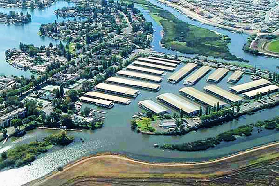
Buckley CoveBuckley Cove is a marina at the western edge of Stockton and adjacent to the Stockton Deep Water Channel.
Five Mile SloughFive Mile Creek, called Five Mile Slough on recent maps, is an urban waterway beginning at Rivara Road and Pacific Avenue in Stockton, California. Storm water is pumped into the creek at this site during the rainy season from November to April. The creek meanders westward through residential areas and the city�s Swenson Park and Swenson Golf Course on its way to 14-Mile Slough just west of Lincoln Village West. where a weir controls the tidal flow from 14-Mile Slough into the creek. The amount of summer tidal flow is reduced by the irrigation water taken from the creek by the golf course and park. 14-Mile Slough connects to the San Joaquin River and thence to San Francisco Bay. On its course it travels under city streets, private bridges and Interstate 5 through city and unincorporated areas. The width of the creek varies from around three feet at Rivara and Pacific to 45 feet in places. During the dry season which runs from April to November, about one quarter of the easternmost part is dry without enough tidal water reaching it. Water depth in the remaining three quarters does not exceed four feet at the center of the creek bed, sloping up to the banks which have severely eroded over the years. At one measureable site, erosion has taken six feet off both banks in the past 30 years.
The creek and its surrounding riparian corridor support a wide variety of birds, mammals, amphibians, reptiles, fish, insects and other invertebrates punctuated by migratory flocks of birds and seasonal individuals.
Fourteen Mile SloughFourteen Mile Slough is at the western edge of Stockton and flows into the Stockton Deep Water Channel. The Village West marina is located here.
Bottom left photo, courtesy of Al Fonseca
Honker Cut SloughHonker Cut Slough is at the west end of Eight Mile Road in Stockton and is Just west of King Island, one of the many San Joaquin Delta Islands.
Right photo: Herman & Helens Marina - 15135 W. Eight Mile Rd.
Mokelumne RiverThe Mokelumne River is a river in Northern California. The Upper Mokelumne River originates in the Sierra Nevada mountain range and flows into Camanche Reservoir in the Sierra foothills. The Lower Mokelumne River refers to the portion of the river below Camanche Dam. It crosses California's Central Valley, flowing westward through Lodi, California, and ultimately meeting its confluence with the San Joaquin River in the Sacramento-San Joaquin River Delta. The river crosses or forms the border of four California counties: Amador, Calaveras, San Joaquin, and Sacramento.
Lost Isle
Lost Isle, Until the place was closed by the county, where they had all the wild parties, fighting and shootings, not to mention all the poor women who went there with hardly anything to wear
�
Pixley SloughPixley Slough is at the northwest corner of Stockton and drains into the San Joaquin Delta. The photos of Pixley Slough below were taken just west of I-5 at the south side of Spanos park
San Joaquin RiverThe San Joaquin River (pronounced /?s�n w???ki?n/), 330 miles (530 km) long, is the second-longest river in California. The average unimpaired runoff of the main stem of the river at Millerton Reservoir is about 1.8 million acre feet per year (2.2 km�). The San Joaquin and its eight major tributaries drain about 32,000 square miles (83,000 km�) of California's San Joaquin Valley. Water from the river is used to irrigate 1,500 square miles (3,900 km�) of highly productive farmland on the east side of the Central Valley where 200 kinds of produce are raised from oranges to cotton.
It originates high on the western slopes of the Sierra Nevada and drains most of the area from the southern border of Yosemite, south to Kings Canyon National Park, making it the second largest river drainage in the state. The San Joaquin River's tributaries include the Stanislaus River, Tuolumne River, Merced River, Calaveras River and Mokelumne River.
Smith CanalSmith Canal is a man-made, historically significant, and navigable urban waterway that extends from the Delta 2.5 miles upstream to Yosemite Lake.
JC Smith was a prominent landowner who moved from Indiana to Stockton in 1852. He was married Harriet Boone (reported to be a relative of Daniel Boone).
Mr. Smith's land flooded annually after the City of Stockton built the North Street Canal to channel floodwaters from Mormon Slough and Calaveras River away from the center of the City. The Canal did not lead out into the Delta, but was excavated west to the city limits and turned down into a smaller ditch. Effectively, this spread the floodwater onto Mr. Smith's land, flooding his crops.
In December of 1880, Mr. Smith sued the City of Stockton in for $2,000 damages. He won a modest settlement for loss of crops and used that money to begin planning a canal to send the water off his land and through to the Delta. Of course, the development of the Canal would then allow Mr. Smith to subdivide his land.
In 1887, The State of California enacted Chapter XCIII to provide for the construction and maintenance of an open canal along North Street for sanitary and drainage purposes. $40,000 was appropriated to the Insane Asylum for the construction and maintenance of those levees and embankments. In 1889 The Board of Directors for the State Asylum reported an open canal will be built (Smith Canal) to discharge stormwater and sewage from the Hospital to the Delta so as to improve relationships with local asylum neighbors offended by hospital sewage.
The Smith Canal was identified on a City/County survey map of 1894 although the exact completion date is not clearly documented in maps from the 1890's.
In 1915, the City of Stockton filled in the North Street Canal to replace the open canal with underground pipes but left the Smith's Extension to the North Street Canal open to the Delta.
How Louis Park got its name
Stanislaus River The Stanislaus River in California is one of the largest tributaries of the San Joaquin River. The river is 65 miles (104 km) long and has north, middle and south forks. The north and south forks meet several miles upstream from New Melones Lake and the middle fork joins the north fork a few miles before that. The Stanislaus river is extensively dammed and diverted. Donnells Dam on the middle fork forms Donell Lake, high in the Sierra Nevada. Downstream is Beardsley Dam, which forms Beardsley Lake. McKays' Point Diversion Dam diverts water on the north fork for hydroelectricity production and domestic use.
The New Melones Dam blocks the river after the confluence of all three forks. Downstream from New Melones Lake, there is Tulloch Dam, which forms Tulloch Reservoir, and Goodwin Dam, which is the first major barrier for anadromous fish on the Stanislaus River. In fact, the Stanislaus River historically supported a large population of spring-run chinook salmon (McEwan 1996; Yoshiyama 1996) which was extirpated with the construction of Goodwin Dam. Below Goodwin Dam, the Stanislaus eventually meets the San Joaquin River and flows into the Sacramento-San Joaquin River Delta. The town of Ripon is also located on the banks of the Stanislaus River.

Stockton Deepwater ChannelWatch commercial vessels make their way in and out of the busy Stockton waterfront shipping yard. As the largest inland seaport in California and one of the largest in the country,
Stockton Port is a vital transportation hub for local produce and manufactured products. The Port of Stockton is a fully operating seaport approximately 75 nautical miles (120 km�) east of the Golden Gate Bridge in San Francisco. Set on the San Joaquin River, the port operates a 2,000 acre (8.5 km�) transportation center with berthing space for 17 vessels.
Tuolumne RiverThe Tuolumne River is one of the major rivers draining the western slope Sierra Nevada mountains of California. It is the slightly larger northern neighbor of the Merced River; both originate in Yosemite National Park. Through successive ice ages, glaciers carved valleys for both the Merced River and the Tuolumne River through what is now Yosemite National Park.
San Joaquin Man Made Lakes
Grupe Lake
Meadow Lake
North Lake
Quail Lake
Shop For Recreational Water Sport Gear & Equipment
See also
|
